Dublin → King John's Castle → Cliff of Moher → Burren National Park → Galway bay → Corcomroe abbey
1. 모허절벽 투어 예약하는 방법

▲ 예매하기

▲ 예매완료

▲ 타는곳
□ 예매하기 : > https://www.irishdaytours.ie/tour/cliffs-of-moher-tour/
□ 가격 : 성인 €45 / 학생 €40 (*가이드, 입장료 포함)
□ 투어시간 : 07:00 ~ 19:30
2. 존 왕의 성 (King John's Castle)

더블린에서 약 2시간을 달려 도착한 곳은 '리머릭'(Limerick)이었다
리머릭은 아일랜드의 3대 도시로 더블린, 코크 다음으로 큰 도시이다.
그리고 이 곳에는 존 왕의 성이 있다.
투어시간 여건으로 성채내부는 관람하지 못하였다.
존 왕 (King John)1
영국 역사상 가장 못난 왕으로 불린 존 왕.
조카를 살해하고 왕위에 올랐다. 선대에서 어렵게 쌓은 대외 영토 대부분을 잃어 무지(無地)왕, 실지(失地)왕이라는 별명을 얻었다. 귀족들의 반대에도 불구하고 직접 나선 프랑스와의 전쟁에서는 참패했다. 교황과 다투다 파문당했다. 그럼에도 그는 역사에 족적을 남겼다.
일반적 영웅들과는 다른 방식이었다. 1215년 6월15일 존 왕은 윈저성 근처 러니미드에서 ‘영국 헌법의 성경’으로 꼽히는 ‘마그나카르타(대헌장)’에 도장을 찍었다.
물론 자발적인 것은 아니었다. 존 왕의 잇따른 실정과 과도한 조세에 반발한 귀족들은 급기야 무력봉기를 일으켰다. 이미 국민들은 왕에게서 등을 돌린 터였다. 결국 존 왕은 귀족대표와 회합해 그들의 요구사항이 담긴 마그나카르타에 ‘울며 겨자먹기’로 도장을 찍을 수밖에 없었다. 왕 역시 법에 종속된다는 것을 스스로 인정한 순간이었다.
존 왕의 성 (King John's Castle)2
아일랜드 먼스터주(州) 리머릭(Limerick)에 있는 중세시대의 성이다.
1200년대 영국의 존왕이 건립한 성으로 킹스섬(King's Island)의 섀넌강가(Banks of Shannon)에 있다. 성은 강에서 올라오는 적을 방어하고 성을 보호하기 위하여 높은 지역에 있다. 성에 오르면 섀넌강과 리머릭 지역을 사방에서 조망할 수 있다.
창건 이후 여러 차례 개축되고 확장되었다. 1642년 대공격으로 리머릭과 성이 모두 유린되고 동쪽의 성벽(East curtain wall)은 파괴되었다. 나중에 이곳에서는 당시의 유골을 포함하여 1,000여 점 이상의 유물이 발굴되었다. 대표적인 유물로는 보석 조각들과 도기로 된 대포, 총알, 황금 등자 등이 있다.
현재 탑과 구부러진 돌 계단, 지하감옥, 1층의 커다란 응접실과 식당 등이 남아 있고 중세시대의 군인 요새가 성의 뒷문 주변에서 발견되었다. 재건한 성벽과 출입구, 통로 등도 있다.
3. 모허 절벽 (Cliff of Moher)

▲ 모허 절벽 (Cliff of Moher)
대자연이 만들어낸 장엄한 작품을 감상할 수 있었다
전체적인 느낌은 포르투갈의 호카곶과 유사했지만, 아일랜드의 바닷물 더 깊은 푸른색을 띠고 있었다.


▲ 모허 절벽 (Cliff of Moher)
해안산책로를 따라 절벽을 감상할 수 있다.
대부분의 영국해안가가 그러하듯, 안전망이 제대로 설치되어 있지 않다.
그 덕에 좀 더 자연을 가까이 느낄 수 있다.
모허 절벽 (Cliffs of Moher)3
아일랜드에 있는 클래어 주의 해안에는 200미터 높이의 거대한 절벽이 8킬로미터나 늘어서서 대서양의 거센 파도와 싸우고 있으니 그곳이 바로 모허 절벽이다. 이 절벽이 도저히 접근할 수 없을 정도로 험한 것은 아니지만 바다에서 곧장 수직으로 솟아 있는 모습을 보면 감탄이 끊이지 않는다. 석회암 기단 부분은 약 3억 년 전에 따뜻하고 얕은 바다에서 형성되었다. 그리고 이 위에 사암층이 연속으로 쌓인 것이다. 퇴적물은 대규모 지각작용으로 형태를 갖추었고 바람과 비와 짠 바닷물이 암석을 깎아내렸다. 결국 절벽의 일부분이 바다로 떨어져 내렸다.
파도는 지금도 끊임없이 절벽의 아랫부분을 공격하고 있다. 절벽 위에 나 있는 길을 따라 가장자리까지 가서 아래를 내려다보면 강한 서풍에 실려 위로 흩날리는 바닷물 세례를 받을 것이다. 아일랜드의 다른 지형들과 마찬가지로 이 절벽도 신화에 자주 등장한다. 절벽의 남쪽 끝단에는 돌로 변한 올드해그몰(늙은 마녀)이 바다를 내려다보고 있다. 절벽의 북쪽 끝에는 요정의 말 한 무리가 날아올랐다는 전설이 있어 오늘날 망아지들의 절벽이라는 뜻의 '에일나세라흐'라는 이름이 붙었다. 이제 말은 없고 절벽은 바닷새의 안식처가 되었다. 절벽의 경사면에 튀어나와 있는 좁은 길에서는 야생염소가 풀을 뜯는다.


▲ O'Brien's Tower
오브라이언 타워는 모허절벽에서 가장 높은 곳에 위치해있다.
고도 덕에 모허절벽을 한 눈에 볼 수 있다.
중세시대가 아닌, 산업혁명 이후인 1835년 건설된 건물이다.
그럼에도 불구하고, 주변경관과 이질감 없고 잘 어울린다.
O'Brien's Tower4
The tower was built on the cliffs in 1835 by local landlord and MP Sir Cornellius O'Brien as an observation tower for the Victorian tourists that frequented the cliffs at the time: "strangers visiting the Magnificent Scenery of this neighbourhood". It is said to have initially served as a teahouse, featuring a large round table with seats of ironwork.
Another version tells of O'Brien building the tower in order to impress women he was courting. On a clear day the view can extend as far as Loop Head at the southern tip of Clare and beyond to the mountains of Kerry. Looking north from O'Brien's Tower on clear days, the Twelve Bens in Connemara (also known as the Twelve Pins) beyond Galway Bay can be seen, and typically the Aran Islands to the west.
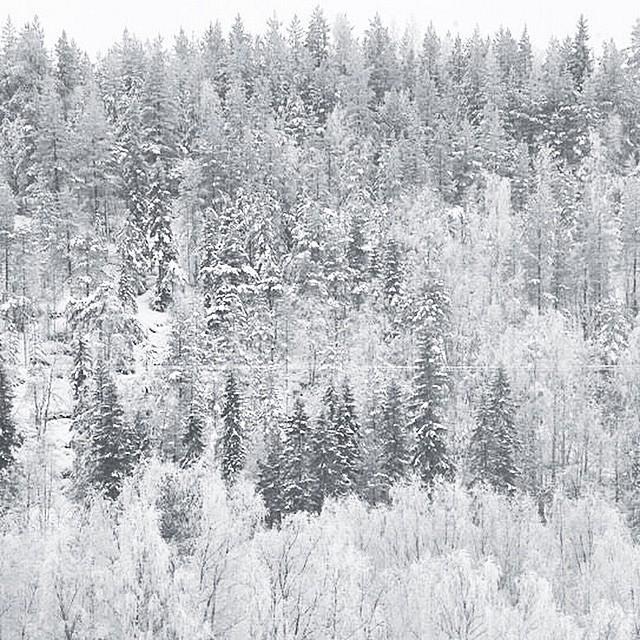
4. 버른 국립공원 (Burren National Park)

채석장마냥 대지는 할퀴어져있다.
갈라진 틈 사이로, 솟아나는 작은 풀들을 보며 강인한 대자연의 생명력을 느낀다.
버른의 석회암질 바위는 물이나 바람에 침해 침식과 용해작용을 거치며 생선된 카르스트 지형이다.
침식으로 인한 바위 구멍에는 작은 습지가 형성되어 있고, 오랜 세월 양분을 함축하여 무척 비옥하다.
▲ Burren Way
Burren History5
The word “Burren” comes from an Irish word “Boíreann” meaning a rocky place. This is an extremely appropriate name when you consider the lack of soil cover and the extent of exposed limestone pavement. However it has been referred to in the past as “Fertile rock” due to the mixture of nutrient rich herb and floral species.
The Burren region is internationally famous for its landscape and flora. A visit to the Burren during the summer months will leave a person amazed by the colourful diversity of flowering plants living together within the one ecosystem. Arctic-alpine plants living side by side with Mediterranean plants, calcicole (lime-loving) and calcifuge (acid-loving) plants growing adjacent to one another and woodland plants growing out in the open with not a tree nearby to provide shade from the sun. Also found here are certain species which although rare elsewhere are abundant in the Burren. Even more amazingly they all survive in a land that appears to be composed entirely of rock.
We must not forget the enormous influence of the farming community in the region, through their farming techniques they have managed the land in such a way as to preserve the unusual flora and habitats that remain today. Not only have these habitats been preserved by the method of management in the region, they have been enhanced and owe their existence to the farming community.
The Burren covers 1% of the land surface of Ireland and is approximately 360 square kilometres in size. Most of the Burren is designated a Special Area of Conservation to protect this extremely unusual habitat. The Burren National Park is located in the southeastern corner of the Burren and is approximately 1500 hectares (15 square kilometres) in size. The Park land was bought by the Government for nature conservation and public access. It contains examples of all the major habitats within the Burren: Limestone Pavement, Calcareous grassland, Hazel scrub, Ash/hazel woodland, Turloughs, Lakes, Petrifying springs, Cliffs and Fen.
In 1651 a Cromwellian Army Officer named Ludlow remarked:
“of this barony it is said that it is a country where there is not water enough to drown a man, wood enough to hang one, nor earth enough to bury them. This last is so scarce that the inhabitants steal it from one another and yet their cattle are very fat. The grass grows in tufts of earth of two or three foot square which lies between the limestone rocks and is very sweet and nourishing.”
The highest point in the Park is Knockanes (207 metres) which continues as a curving terraced ridge to Mullaghmór to the south. East of this ridge is an area of extensive, low-lying limestone pavement containing a number of semi-permanent lakes. West of this ridge, the pavement sweeps down to partially drift-covered ground which gradually rises again to reach the foot of a rocky escarpment. To the south of the Park, the limestone bedrock disappears under a layer of glacial till. This till area is far more intensively managed for pasture and silage.
5. 골웨이 (Galway bay)

비긴어게인 촬영지로 더 유명한 '골웨이(Galway)'
골웨이는 소박하고 조용한 마을이다.
무엇을 보러 오겠다는 각오보다는, 더블린에서 지친 몸을 녹이러 오는 편이 적당한 것 같다.
▲ <비긴어게인> 골웨이편, 'Moonriver'
골웨이 (Galway)6
아일랜드 골웨이 주의 주도. 골웨이 만의 북안에 면하고 있는 항구 도시로 13세기에 앵글로노르만의 이주민이 건설하였다. 지명은 아일랜드 어에서 유래하는데 '작은 섬들이 있는 항구'라는 뜻이다. 양모, 농산품, 검은 대리석, 도자기, 마, 모직물 등을 수출하며, 제분업, 철강업 등이 성하다. 13세기에 건축된 성 니콜라스 교회에 기원을 둔 국립 대학이 있으며, 켈트 문화 연구의 중심지이다.
6. 코컴로 수도원 (Corcomroe abbey)

12세기에 세워진 코컴로 수도원(Corcomroe Abbey)이며, 수녀들의 묘지가 보존되어 있다.
투어 마지막 코스라 그런지, 다들 지친 몸을 이끌고 비몽사몽 수도원에 발을 디뎠다.
우리 외에도 경건하게 기도를 올리는 사람들도 있었다.

Corcomroe Abbey7
Corcomroe Abbey (Irish: Mainistir Chorco Modhruadh) is an early 13th-century Cistercian monastery located in the north of the Burren region of County Clare, Ireland, a few miles east of the village of Ballyvaughan in the Barony of Burren. It was once known as "St. Mary of the Fertile Rock", a reference to the Burren's fertile soil.
The Romanesque ruins feature stone carvings that are considered to be among the finest in a Cistercian church in Ireland. The abbey appears in W.B. Yeats' play The Dreaming of Bones.[1]:14 They constitute a National Monument and are open to the public.
- http://news.khan.co.kr/kh_news/khan_art_view.html?art_id=201006141745265#csidxdacdfae538e9b6b8e618759a19c6c68 [본문으로]
- [네이버 지식백과] 존왕의 성 [King John's Castle] (두산백과) [본문으로]
- [네이버 지식백과] 모허 절벽 [Cliffs of Moher] (죽기 전에 꼭 봐야 할 자연 절경 1001, 2008. 1. 16., 마로니에북스) [본문으로]
- https://en.wikipedia.org/wiki/O%27Brien%27s_Tower [본문으로]
- https://www.burrennationalpark.ie/visit-us/history/ [본문으로]
- [네이버 지식백과] 골웨이 [Galway] (세계지명 유래 사전, 2006. 2. 1., 성지문화사) [본문으로]
- https://en.wikipedia.org/wiki/Corcomroe_Abbey [본문으로]
아일랜드 더블린 당일치기, 아일랜드 더블린 맛집, 아일랜드 더블린 관광, 아일랜드 더블린 관광지, 산, 아일랜드 더블린 여행, 아일랜드 더블린 여행코스, 아일랜드 더블린 당일치기 코스, 아일랜드 더블린 명소, 아일랜드 더블린 아일랜드 더블린 여행, #아일랜드 더블린당일치기 #아일랜드 더블린맛집 #아일랜드 더블린관광 #아일랜드 더블린관광지 #아일랜드 더블린여행 #아일랜드 더블린여행코스 #아일랜드 더블린당일치기코스 #아일랜드 더블린명소 #아일랜드 더블린아일랜드 더블린여행, 아일랜드 더블린 여행 필수 코스, 아일랜드 더블린 여행 경비, 아일랜드 더블린 여행 코로나, 아일랜드 더블린 여행 패키지, 아일랜드 더블린 여행 일정, 아일랜드 더블린 여행 후기, 아일랜드 더블린 여행 블로그, 11월 아일랜드 더블린 여행, 아일랜드 더블린 유명한 음식, 아일랜드 더블린 관광지 순위, 아일랜드 더블린 여행코스, 아일랜드 더블린 여행 지도, 아일랜드 더블린 여행 일정짜기, 아일랜드 더블린 1주일, 아일랜드 더블린 필수코스, 아일랜드 더블린 여행 비용, 부모님 아일랜드 더블린 여행, 아일랜드 더블린 가족여행, 아일랜드 더블린 배낭여행, 아일랜드 더블린 패키지 여행 경비, 8월 아일랜드 더블린 여행, 아일랜드 더블린여행필수코스 #아일랜드 더블린여행경비 #아일랜드 더블린여행코로나 #아일랜드 더블린여행패키지 #아일랜드 더블린여행일정 #아일랜드 더블린여행후기 #아일랜드 더블린여행블로그 #11월아일랜드 더블린여행 #아일랜드 더블린여행지 #아일랜드 더블린자유여행 #아일랜드 더블린유명한음식 #아일랜드 더블린관광지순위 #아일랜드 더블린여행코스 #아일랜드 더블린여행지도 #아일랜드 더블린여행일정짜기 #아일랜드 더블린1주일 #아일랜드 더블린필수코스 일랜드여행비용 #부모님아일랜드 더블린여행 #아일랜드 더블린가족여행 #아일랜드 더블린배낭여행 #아일랜드 더블린패키지여행경비
'Travel > 아일랜드' 카테고리의 다른 글
| [아일랜드] 호스 (Howth) - 더블린 근교, 30분 거리 휴양지 (0) | 2018.11.16 |
|---|---|
| [아일랜드] 더블린 (Dublin) - 한국인들은 동양의 아일랜드인이다(?) (0) | 2018.11.15 |